
RIDOT Opens New East Bay Bike Path Bridges
The Rhode Island Department of Transportation recently hosted an event celebrating the completion of the $25.9 million East Bay Bike Path Bridges project that replaced two bridges that carry a key bikeway over the Barrington and Palmer Rivers.
[Above photo by RIDOT]
The new structures – originally built in the 1880s to carry freight trains – were converted from railroad to bike path bridges in the 1980s. RIDOT had to close the bridges in late 2019 due to their deteriorated and unsafe condition, the agency said.
The new bridges – each approximately 300 feet long and 14 feet wide – help link up several bike path segments to form a continuous 14.5-mile bikeway from Providence to Bristol.
RIDOT said it used prefabricated modular truss Acrow bridges to construct the two new structures as that design is easier to maintain, quicker to install, impacts the environment less, and offers a long design life. The lighter weight design of the Acrow bridges also required smaller foundational elements and piers, the agency noted.
“Today is a great day as we celebrate the restoration of these bridges for our beloved East Bay Bike Path,” noted Governor Dan McKee (D) in a statement. “We’re so appreciative of the efforts of our congressional delegation to secure the additional funding necessary to complete the project, which will be enjoyed by residents and visitors alike for generations to come.”
Given the popularity of the East Bay Bike Path and the importance of replacing these bridges for cyclists and pedestrians, RIDOT said it reallocated $10 million within its 10-year-plan to fund the bridges.
The agency added that Sen. Jack Reed (D-RI) and Sen. Sheldon Whitehouse (D-RI) were “instrumental” in helping deliver $14 million in federal funds, including a $5 million federal earmark, to compete the double bridge project.
Responding to public input during the permitting process for fishing access points, RIDOT said it modified overall scope of the two-bridge project to include two fishing piers.
“RIDOT was committed to working with our federal, state and local partners to advance this project and deliver it to the communities,” added Robert Rocchio, RIDOT’s interim director. “[They are] important links for the state’s oldest and most popular bike path.”
Environmental News Highlights- April 8, 2026
MoDOT Completes Wildlife-Vehicle Collision Study
In late February, the Missouri Department of Transportation published a final report about its Wildlife-Vehicle Collision (WVC) Study and Prioritization Project; the culmination of almost two years of research aimed at making state roads safer for both motorists and wildlife alike.
[Above photo by MoDOT]
The agency described this research as “extremely pertinent” as, from 2019 to 2023, Missouri suffered 17,609 WVCs with 8 to 10 percent of them resulting in an injury or fatality. The state also ranked 17th in the nation for WVCs in both 2024 and 2025, according to the agency’s study.
“Knowing where those [WVC] locations are, and knowing when there is overlap between planned projects and collision areas, [can help us] incorporate mitigation measures to help drivers stay safe,” explained Caleb Knerr, a senior environmental specialist with MoDOT, in a news story about the agency’s research.
The agency split its WVC research – which relied in part on grant funding from the Federal Highway Administration’s Wildlife Crossings Pilot Program – into two phases.
The first, which began in fall 2024, analyzed key findings from extensive data collected by the Missouri Department of Conservation and the Land Learning Foundation. That process entailed feeding previously collected datasets of vehicle collisions, carcass reports, and habitat studies, into an “Optimized Hot Spot Analysis” or “OHSA” tool developed by Environmental Systems Research Institute or ESRI, which mapped thousands of potential WVC hotspots statewide.
[Editor’s note: Safety initiatives like this one reflect one of the key emphasis areas of Russell McMurry, commissioner of the Georgia Department of Transportation, for his 2025-2026 term as president of the American Association of State Highway and Transportation Officials.]
MoDOT combined this data with 25 established “priority species” listings and subsequently identified 627 of the most critical vehicle-wildlife conflict hotspots across the state that required mitigation strategies.
This is where phase two of the study kicked in, as researchers evaluated and classified the top 10 hot spots based on land use, constructability, and funding – details gleaned from both a cost-benefit and environmental analysis of each location focused on finding the most reasonable implementation strategy.
MoDOT added that it is confident this study will help provide a “statewide blueprint” for planning and building wildlife crossing infrastructure and for incorporating wildlife considerations into the agency’s future planning, design, construction, and maintenance operations.
State DOTs Gain Risk Management Insight at ResCon
In mid-March, staff from the American Association of State Highway and Transportation Officials attended ResCon, an annual conference in New Orleans focused resilience and disaster response and recovery, to learn about different tactics and tools state departments of transportation can use to improve their risk management strategies.
[Above photo by AASHTO]
Originally launched in 2012 as the International Disaster Conference and Expo, ResCon attracts a diverse group of chief resilience officers and practitioners, emergency management officials, policy and decision makers, academia, and leaders from both the public and private sector to its yearly gathering.
The conference agenda explored a range of topics central to resilience, including coastal protection and restoration, flood and stormwater management and recovery, innovative technologies, homeland security, the impact of potential reforms to the Federal Emergency Management Administration, and the fundamentals of resilience, response, recovery, and mitigation.
One of the key tactics discussed at the 2026 ResCon meeting revolved around the use of “parametric insurance” for risk management. Parametric insurance does not rely on a complex loss adjustment process and provides greater transparency by using pre-agreed physical parameters and payout structures that can cover multiple locations and assets – payouts made in a matter of days after an event, eliminating delays in available liquidity.
Speakers at ResCon explained that deploying parametric insurance for public assets is more popular outside of the United States, most commonly in the Caribbean; however, it has been used to insure public assets against floods along the Florida coastline.
With the rapidly increasing intensity and frequency of extreme weather events, parametric insurance can help infrastructure sectors recover from risks like extreme weather that are known, but hard to quantify – risks otherwise known as “grey swan” events.
However, extreme weather is not the only hazard for which state DOTs must plan and prepare, as the threat scope state agencies face includes geological events, wildfires, and cyberattacks, among many others. Those threats can become particularly acute during large-scale planned events, such as the upcoming 2026 FIFA World Cup soccer tournament and the 2028 Summer Olympics in Los Angeles and 2034 Winter Olympics in Salt Lake City.
ResCon presenters noted that there is no single strategy or practice that will work for every state, nor can a state deploy a single practice or strategy to counter all possible threats. Rather, state DOTs should work to improve their collaboration, both nationally and regionally, holding emergency management peer-exchanges and workshops to advance common risk management frameworks.
In that role, AASHTO works to assist states to identify gaps in data and capabilities, remove barriers to implementation, share emergency management practices, and execute shared resilience priorities – a major reason why AASHTO remains a committed participant of conferences like ResCon and will continue advancing those response and recovery lessons learned.
Environmental News Highlights – April 1, 2026
Learning From a TxDOT Bat Cave Mitigation Project
The Texas Department of Transportation recently detailed some of the broader insights gleaned from a bat cave mitigation project that the agency hopes to use for other endangered species across the state.
[Above image from TxDOT]
TxDOT shared that information during a webinar in February; part of a webinar series hosted by the American Association of State Highway and Transportation Officials Committee on Environment and Sustainability.
Texas is home to more than 300 federal and state listed endangered and threatened species, including millions of bats, invertebrates, birds, and large mammals. As a result, TxDOT always builds the state’s transportation infrastructure with one eye out for the needs of any such creatures living near it.
For example, a recent improvement project to State Highway 151 between Loop 1604 in San Antonio uncovered several types of endangered creatures living nearby – including rare species of spiders living in caves and karst features in the limestone bedrock.
To comply with the Endangered Species Act, offset their impacts, and keep the project moving, TxDOT got creative.
Enter the Wurzbach Bat Cave: an underground feature west of the project in a residential area. The cave provided the perfect spot to preserve and protect a space for the invertebrates and bats. However, there was a roadblock: the more than quarter-mile long cave sat 72 feet below a bustling neighborhood of houses and pools.
As a result, in 2023, TxDOT successfully purchased the undeveloped property with the cave’s entrance and most of the footprint of Wurzbach Bat Cave itself; marking the first time TxDOT bought residential land as part of a highway mitigation effort.
The department then transferred the deed for the cave area to the Texas Cave Management Association or TCMA, TxDOT’s partner, on the project.
[Editor’s note: TxDOT filmed a video about this project (seen below) as a part of its “Beyond the Road Campaign,” which tells stories about the agency’s natural, cultural, and community initiatives.]
With the Wurzbach Bat Cave successfully in the process of preservation, TxDOT and TCMA then had to figure out a way to attract bat colonies back to the cave’s ecosystem.
“At one time, [the cave] had 20,000 to 40,000 bats roosting here in the summer months,” explained Tim Kennedy, TCMA’s vice president, in a TxDOT video about the cave project.
Because of the cave’s fragile environment, Kennedy stressed that previous owners had built steel bars over its entrances to keep people from going in and damaging the area. However, those steel bars “also kept the bats out,” he said, forcing the winged mammal to search elsewhere to sustain their livelihood.
So TxDOT and TCMA joined forces once again, this time to design and install bat-friendly entrances on all four of the Wurzbach cave’s openings. With the new additions, Kennedy said that “we are just waiting to see if the bats will ever re-find the cave and recolonize this [area].”
Because of TxDOT’s partnership with TCMA, the cave will continue to be a safe haven for several of Texas’s endangered and threatened species, noted Juan Alacazar, a TxDOT environmental specialist and biologist, adding in the video that the habitat “is not going to be disturbed. It’s going to stay like this forever.”
Maryland DOT Supporting Baltimore Watershed Resiliency Projects
The Maryland State Highway Administration (MDOT SHA) – a division of the Maryland Department of Transportation – and the South Baltimore Gateway Partnership or SBGP recently entered into a 15-year “master memorandum” of understanding to advance nature-based resiliency projects in the Baltimore Harbor Watershed.
[Above photo by SBGP]
Through this partnership, MDOT SHA and SBGP will identify, design, fund, and implement projects that manage stormwater runoff, improve water quality and strengthen climate resilience in and around the communities of South Baltimore.
“These collaborative, nature-based solutions help advance Maryland’s environmental goals while delivering meaningful benefits to local communities,” said Kevin Wilsey, director of MDOT SHA’s Office of Environmental Design, in a statement. “This partnership maximizes public investment and supports long-term resiliency in the Baltimore Harbor Watershed.”
The agreement also dovetails with MDOT SHA’s commitment to advancing investments that reduce polluted runoff and support the health of the Chesapeake Bay and local waterways, the agency said.
It also supports SBGP’s implementation of the Middle Branch Resiliency Initiative, a comprehensive effort focused on restoring damaged ecosystems, improving water quality, expanding public recreation and active transportation opportunities and reducing coastal hazards such as flooding, erosion, storm surge, and sea level rise, MDOT SHA added.
The Middle Branch Resiliency Initiative is the shoreline restoration arm of Reimagine Middle Branch; a community-driven initiative to reconnect South Baltimore communities and shorelines, which SBGP leads in partnership with Baltimore City and the Parks and People Foundation.
“The Middle Branch Resiliency Initiative is about restoring the harbor in ways that benefit both people and nature,” noted Samantha Rose, SBGP’s restoration director. “Through partnerships like this with MDOT SHA, we can advance projects that improve water quality, restore our shorelines and create more resilient and welcoming waterfront spaces for South Baltimore communities.”
Environmental News Highlights – March 25, 2026
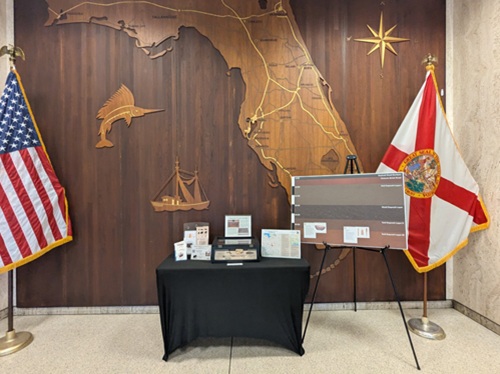
Florida DOT Archaeologists ‘Dig’ the Museum Scene
What began as a futile search for space to warehouse tons of stuff literally dug out of the ground over several decades resulted in the Florida Department of Transportation developing a new specialty – museum curating.
[Above photo by Florida DOT]
Florida DOT’s Archaeological Collections & Curation is just getting started as the museum only exists online for now. But the agency is building a template other state departments of transportation could potentially follow as more road and bridge projects uncover more artifacts as part of the National Environmental Policy Act or NEPA process.
It started in 2016, when Florida became the fourth state to accept an assignment of NEPA responsibilities on federal-aid projects from the Federal Highway Administration. The agreement with FHWA meant Florida DOT could save time and money on projects, but it also meant the department would have to assume some other responsibilities.
In the past, materials that had been excavated during the NEPA process would go to the Florida Bureau of Archaeological Research. Since 2017, all those pottery shards, arrowheads, cooking utensils, and anything else that had historical or cultural significance had to be stored by Florida DOT.
Some was housed in backrooms and closets in district offices, and some in consultants’ offices. The bulk of it continued to accumulate across the state, with no plan of what to do with it.
Florida DOT decided to offer the materials – no one knew exactly how much there was – to Florida museums, which specialize in making such raw materials available to the public. But there were no takers.
“Then we tried the museums along the east coast,” explained Lindsay Rothrock, the agency’s state cultural resources coordinator. “Then, we just looked anywhere in the country that had space that met federal requirements.”
No one wanted it.
“It came to the forefront that we would have to start curating our archaeological materials,” Rothrock said. “We had to be a bit more formal in our archaeological collection.”
Rothrock said she and her colleagues “felt comfortable managing the physical collection because that’s something we’re trained to do. We wanted to go a step further because, hey, there’s some interesting and cool things here.”
In 2023, Florida DOT started the slow process of moving all the materials that had been gathered since 2016 to a space in the central office complex in Tallahassee. As the boxes arrived, teams would document the contents into a database.
Three years later, the boxes are still coming in, but now Florida DOT has a dedicated curation room where everything that comes into headquarters is recorded and stored. The new space also includes an archaeology lab to process artifacts.
So far, the agency said it has recorded about 111,000 artifacts, with “a couple of hundred boxes we’re still going through,” Rothrock said. “We’ve realized we have some interesting things.”
Top of the list for Rothrock was an excavation for a road project at the site of an old turpentine camp. From the mid-1800s through the 1920s, such camps collected pine resin and tar to support the ship-building industry popped up across the state.
Those camps, notorious for their rough treatment of workers, were thought to be populated almost exclusively by nomadic men looking for work. But archaeologists learned the camps were home to a much broader community of people, Rothrock said.
“We found evidence of kids at the site, of whole families at these camps,” Rothrock said. “There were pieces of porcelain dolls, metal jacks – these small little things talk to us about a larger population living there.”
The online museum, which is hosted on Florida DOT’s Office of Environmental Management page, contains a section called “History’s Mysteries,” a virtual set of items collected from the department’s projects. Each item tells a story, and Rothrock and her colleagues are eager to share those stories with the public.
“We’ve got plans coming out of our ears,” she said. “We’re going to need to nail down more space.”
For now, as part of its commemoration of “Archaeology Month” in March, Florida DOT featured artifacts in the main lobby of its headquarters building in Tallahassee to educate people about how archaeologists interpret what they discover during field work. A display case in the lobby also contains “mystery artifacts,” the nature of which are revealed week-by-week.
The agency added that it is also planning to hold an “open house” in the near future to showcase its new curation room and archaeology lab.