State department of transportation crews along the Gulf Coast prepared for the arrival of two potentially dangerous storms this week – highlighting the key ways state DOTs protect critical infrastructure and the residents it serves during severe weather events.
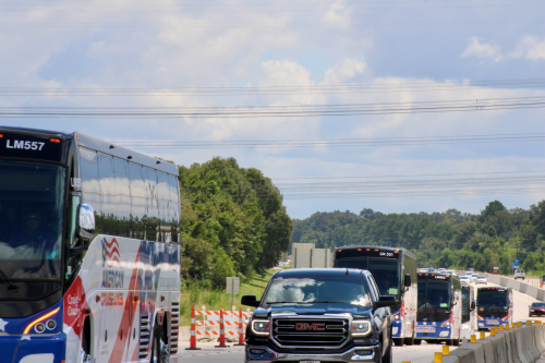
[Above photo courtesy of Louisiana DOTD.]
Crews in Texas, Louisiana, and Mississippi cleared storm drains and ditches, lowered light masts, paused highway construction projects and pre-positioned barricades, signs, and portable dams to prepare for the impact of hurricanes Marco and Laura – even as forecasts for the intensity and paths those storms changed almost hourly.
“Hurricanes are part of living here,” explained Sarah Dupre, a public information officer with the Texas Department of Transportation.
“We’re treating it just like one big storm,” added Rodney Mallet, communications director for the Louisiana Department of Transportation and Development.

Part of Louisiana’s preparations means removing tolls on the Louisiana Highway 1 Bridge to accommodate a mandatory evacuation of Grand Isle, the state’s only inhabited barrier island. The Louisiana DOTD also pre-positioned dozens of school buses and motor coaches in other vulnerable areas throughout south Louisiana to aid with potential evacuations.
By Sunday, Mississippi Department of Transportation crews had removed computerized traffic light controllers from major intersections south of Interstate 10 and set the traffic signals to all-flash mode, noted Katey Roh, a public information officer with the agency. That action protects the controllers from floodwaters, while the controllers “flash mode” helps move potential evacuation traffic better than allowing the signals to run on regular cycles.
Although Mississippi does not have a contraflow plan – a situation in which vehicles travelling on a main road in one direction must use lanes normally used by traffic travelling in the opposite direction – it works closely with Louisiana DOTD’s contraflow plan. That plan uses all northbound and southbound traffic lanes on Interstate 55 and Interstate 59 to evacuate the greater New Orleans area into central and north Mississippi. As of Tuesday morning, neither Louisiana nor Texas had implemented a contraflow plan.
“Contraflow is a last resort,” explained TxDOT’s Dupre. “Right now, our crews are preparing for evacuations, and we have dispatched courtesy patrols to help motorists.”
Those three state DOTs also stressed that personnel and equipment must be pre-staged in relatively safe locations to respond to the most vulnerable, low-lying areas in the wake of a storm’s passage. “The most important thing is to make sure our resources are in the right places,” Mississippi DOT’s Roh said. “We’ve been through a number of storms like this, and we know which areas tend to flood, so our first responders are ready to go.”
 Infrastructure


